Follow a thread
A collection keeps its full list as you open different places. Previous, Next and the place chooser help you follow your curiosity. Returning to browsing restores your starting position.
 pattayaengine.Open explorer
 A visual way to understand the coast, see what’s around an idea and keep the places you want to come back to.
Browse three visual collections, choose one of four coastal areas, or filter the discovery library by what interests you. The library contains 20 researched ideas: 17 on the coastal map and three farther-south day ideas. In Search & filter, choose Unopened to find something new, or Saved to revisit the discoveries you kept. These choices combine with your interest, area and search. Your open collection stays together; the library updates when you return.
A collection keeps its full list as you open different places. Previous, Next and the place chooser help you follow your curiosity. Returning to browsing restores your starting position.
Open a place to see its description, source-backed facts and nearby mapped guides. Matched archive photographs show their real subjects; location studies show source geography where no matched photograph is available.
The three visual collections connect discoveries by theme. Open any member, then use Previous, Next or the place chooser to keep that collection together. Your opened-place count belongs to your own browsing; it does not measure a destination’s popularity.
Start at the shoreline. See the bay from above. Find the headland between them.
Wooden carvings, painted illusions, miniature landmarks and collections of the unusual.
Destination-themed shopping floors, a beachfront mall and an aquarium viewing tunnel.
These are browsing threads rather than verified itineraries. The dated place notes describe their subjects and limitations.
Use the four coastal collections to understand how the existing discoveries are grouped. Each has three browsing threads in the explorer. These groups describe map context; they do not rank areas or recommend where to stay.

Wong Amat sits on the Naklua side of the city, north of the main Pattaya Beach curve. The Sanctuary of Truth gives this coast an architectural anchor. Farther south, Terminal 21 and Art in Paradise bring shopping and illusion art into the same part of the map; Mini Siam sits farther east. Browse the coast and the inland attractions separately to understand the distances between your ideas.
Editorial grouping and relative directions derived from existing OSM positions. No claim of a continuous beach route or walkable connections.
Collection sources & scope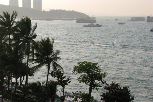
Pattaya Beach and Beach Road define the main bay. Shopping and dining line the central and southern waterfront, with Central Pattaya and Ripley's offering two very different indoor stops. Walking Street sits toward the southern end, in the direction of Bali Hai. Use the bay's shape to orient yourself first, then choose a place that matches what you want to do.
Geographic overview, not live crowd reporting or an assertion that every waterfront section has the same uses.
Collection sources & scope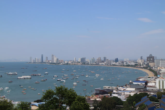
Phra Tamnak is the hill between South Pattaya and Jomtien. Its viewpoint looks back across the main bay; the Pattaya City sign belongs to the same headland. Wat Phra Yai is a separate temple destination centered on the golden Big Buddha. Toward the coast, Pattaya Park Tower and Dongtan Beach offer another way to explore the area. Open each record to distinguish the experience before choosing a stop.
TAT supports the hill's location between the two beach areas. The municipal document supports the sign's hill setting. No slope, accessible route or journey duration inferred.
Collection sources & scope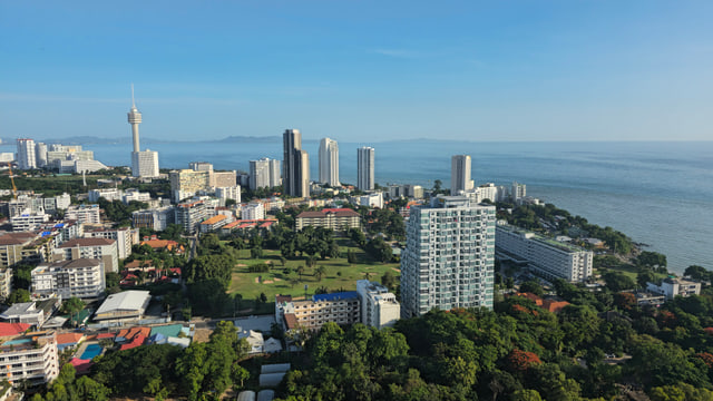
Jomtien is a distinct shoreline south of the main Pattaya bay, with a beach extending roughly six kilometres. Its inland choices include the four-region Floating Market and Underwater World on Sukhumvit Road. Beyond the urban waterfront, Nong Nooch, Khao Chi Chan and Aquaverse belong to the Na Jomtien–Sattahip side of the region. Treat those as separate day ideas, rather than nearby stops on a Jomtien beach walk.
This editorial area includes clearly labeled wider-region day ideas. It is not a municipal boundary, and it does not claim these attractions are adjacent or connected by a verified route.
Collection sources & scopeThe atlas adds spatial context when you need it. Choose a mapped guide, reveal selected everyday amenities or place a pin for a hotel or condo you are considering.
Source points may be mapped centers or representative positions. Nearby and comparison distances are approximate straight-line separations between those points. They are not walking routes, journey times or access advice.
The detailed backdrop uses OpenFreeMap vector tiles from OpenStreetMap. Guides, orientation points and everyday amenities retain their separate dated source records. A local coastal map remains available if city detail cannot load. The optional Tilt view uses selected source building footprints with clearly disclosed illustrative heights.
The weather outlook is requested only when opened. It uses a MET Norway model forecast for one Pattaya reference point, with forecast, retrieval and expiry information. Check the displayed times before using it to make plans.
Save mapped places, farther-south day ideas and your own named pins to My places. Keep up to eight named plans on this device. Mark your ideas as considering or chosen, add private notes, reasons, groups and tags, and change their order. Back up the active plan as JSON, print it or download a readable version. Importing shows a preview before adding anything; sharing previews the exact text and leaves out personal points, notes and your plan name until you select them. Revisit the guides you have opened. In Compare, choose two mapped discoveries or saved locations from the searchable picker. Visual A/B cards let you look closer, save or change either choice. Your comparison choices and selected reference places are retained with your plan. Compare their approximate straight-line distances to coastal places, landmarks or shopping points, and open the atlas for spatial context. The picker and distance table remain available if the interactive map cannot start.
Your plan, comparison choices, opened-place history and motion preference use this browser on this device. In browsers that support coordinated local saves, the explorer reconciles plan edits between open tabs. If durable saving is unavailable, it tells you that new edits stay only for this visit; export before leaving. The shared map link contains the selected coordinates. Anyone receiving it can open that location. Custom pin names and your complete shortlist stay on your device.
Try the coastal atlasDescriptions summarize dated digital sources, including tourism authorities and destination operators. The original place facts retain their 2 October 2026 source checks. Original place-source notes were compiled on 4 October 2026; the browsing context was assembled on 6 October 2026 from that existing record. Neither assembly date is a new source check. The added descriptions were digitally researched on 8 October 2026; each has separate source links and retrieval limits in the source notes.
There are no field visits or firsthand reviews behind these descriptions. Collection themes and area groupings organize the existing guides; they are browsing threads, rather than recommended travel routes. Opening counts describe your own browsing, not a place’s popularity.
Archive photography retains its photographer, capture date, original file and license. A photograph describes the place when it was taken; it does not establish current conditions. Original abstract category artwork illustrates garden, cliff and water themes; it does not depict a destination.
Current opening hours, tickets, prices, availability, water conditions, live crowds and transport demand are outside this dataset. Use the linked primary source for current visitor information. Unknown or conflicting details stay limited to what their source notes support.
Read the source notesThe explorer has no account requirement or advertising tracker. Your separate plans, private notes and browsing history use local browser storage. JSON backups and readable private downloads include personal details. Sharing starts with public discoveries only, then lets you choose which personal points and private details to include. Clearing the site’s storage removes them; they do not synchronize between devices. Other open current-version tabs read the cleared plan before retaining a new edit. To move a shortlist, export it from My places and import that file in the other browser or domain. Importing reads the file locally and does not upload it. A saved map record absent from the loaded snapshot stays marked unavailable, with its original data retained for export and removal. Known mapped records resolve to the current source coordinates; unavailable records are excluded from map actions and comparison.
Guide records, the coastal fallback map and archive photographs are delivered with this site. Opening the atlas requests detailed vector tiles and map-label fonts from OpenFreeMap. That provider receives your IP address and the requested map area; your saved list and custom pin names are not sent. Its privacy policy explains its logging practices. Find in Google Maps opens an external name search; a personal pin opens its coordinates. Opening the weather outlook sends the fixed Pattaya forecast request to MET Norway; that provider receives your IP address. Following an external source link takes you to that provider, whose own privacy terms apply. No device location is requested.
Ambient motion can be paused from the header, and reduced-motion preferences are respected. The reference pages work without JavaScript; interactive discovery, saving and the atlas require it. About this map offers a low-data preference that limits previews and adjacent-image loading; full photographs remain available explicitly. Its optional offline download keeps guide text, sources, fonts and explorer tools in this browser with their original dates. It starts only when chosen. Downloaded information may be stale; photographs, interactive maps, weather and external sources need a connection. Removing the download leaves local plans untouched.