See where the place information comes from, what each map point means and when the archive photographs were taken.
SOURCES & PLACE NOTES ⌄
What these notes support
Original place facts were checked on 2 October 2026 and their notes compiled on 4 October 2026. Added descriptions were digitally researched on 8 October 2026 with separate citations below; this does not refresh the original facts or every source. Descriptions cover enduring identity and setting. Check the primary source for current visitor details.
Each place has a stable section link, its factual summary, added reading and source limits. The reading explains the subject and compares it with related guides; comparisons are editorial organization, not operator recommendations. Map positions have a separate OpenStreetMap source. Archive photos retain separate capture dates and licenses. A source-backed identity is not a firsthand recommendation.
Place notes
01
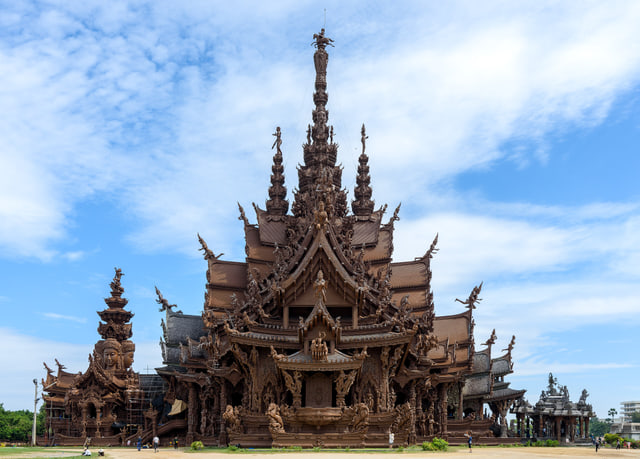
Sanctuary of Truth
Wooden architecture · Wong Amat & North
Explore a museum built around carved wooden architecture and Eastern philosophy, on the Naklua shoreline.
Carvings with a story
The Sanctuary of Truth is a museum expressed through carved wooden architecture on Pattaya's northern coast. Its operator presents the sculptures as a way to explore questions about human origins, the life cycle, family and society. Traditional wood-joining techniques are part of the building's identity, alongside the carved figures and patterns.
The useful distinction is the combination of a full-size architectural structure and philosophical storytelling. Compare it with Art in Paradise for painted perspective illusions, or Mini Siam for architecture recreated as small landmark models.
Sources for the added description
Digitally researched on . Comparisons organise the supported place descriptions; they are not recommendations from the cited operators.
Wood construction and museum philosophy; largest/superlatives excluded.
Museum operator ↗ Accessed 8 October 2026 · retrieved indexed primary text; direct access limited.
Seven philosophical themes; belief interpretation attributed to operator, not asserted as universal truth. Direct page initially identified but later section/find requests returned internal errors; proposed claims rely on retrieved indexed operator text.
Provider resize; CSS crops and tones the image for display. Original photograph retained by its source. Small interface thumbnails are local proportional resizes and JPEG re-encodings of the display photograph. No crop or subject edits; source author, capture date and license are retained.
Explore the sand and the adjoining Beach Road waterfront, then locate the shopping centers behind the coast.
Understand the main bay
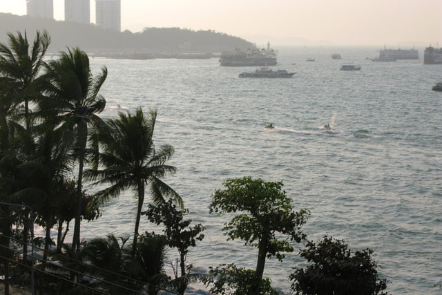
Pattaya Beach is the central bay's waterfront, with Beach Road running beside the sand. TAT describes the adjoining road as extending for approximately three kilometres, with shopping and restaurant uses along its central and southern sections.
Use the shape of the bay to distinguish a waterfront idea from the shopping and entertainment places behind it. Central Pattaya is a beachfront shopping complex; Walking Street belongs to the southern waterfront toward Bali Hai. Jomtien is a separate shoreline south of Pattaya Beach, described by TAT as roughly six kilometres long.
Sources for the added description
Digitally researched on . Comparisons organise the supported place descriptions; they are not recommendations from the cited operators.
Beachfront complex, department-store/cinema, forecourt and hotel composition; tenant counts/occupancy/superlatives excluded. No availability guarantee.
Provider resize; CSS crops and tones the image for display. Original photograph retained by its source. Small interface thumbnails are local proportional resizes and JPEG re-encodings of the display photograph. No crop or subject edits; source author, capture date and license are retained.
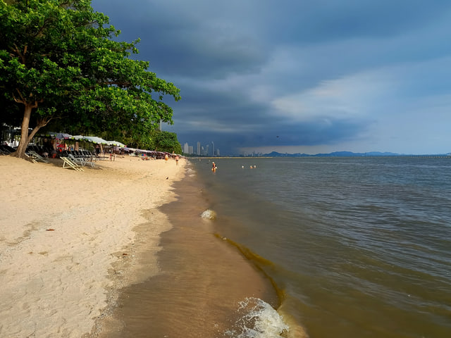
Explore the longer southern part of Pattaya's beach geography and choose a section of the Jomtien waterfront to visit.
A shoreline beyond the headland
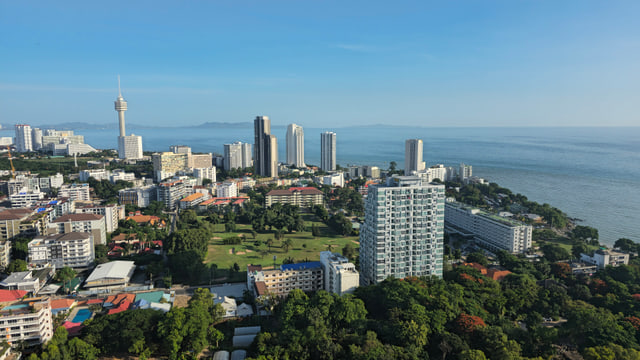
Jomtien is a separate beach area south of Pattaya's main bay. TAT describes it as a largely straight shoreline of roughly six kilometres, with a road running parallel to the shore. Phra Tamnak is the hill separating South Pattaya and Jomtien, which helps explain why the two beach areas sit on different sides of the headland.
Browse Jomtien by its coastal position before comparing inland attractions such as the Floating Market and Underwater World. Dongtan is kept as its own beach record at the northern edge of this part of the explorer.
Sources for the added description
Digitally researched on . Comparisons organise the supported place descriptions; they are not recommendations from the cited operators.
Extent is approximate, not a surveyed boundary. The map point is a bounds center, not a preferred beach entrance. No current water or crowd conditions are stated.
Provider resize; CSS crops and tones the image for display. Original photograph retained by its source. Small interface thumbnails are local proportional resizes and JPEG re-encodings of the display photograph. No crop or subject edits; source author, capture date and license are retained.
Look over the curve of Pattaya Beach and explore the hill's temple and naval memorial context.
The hill, temple and naval monument
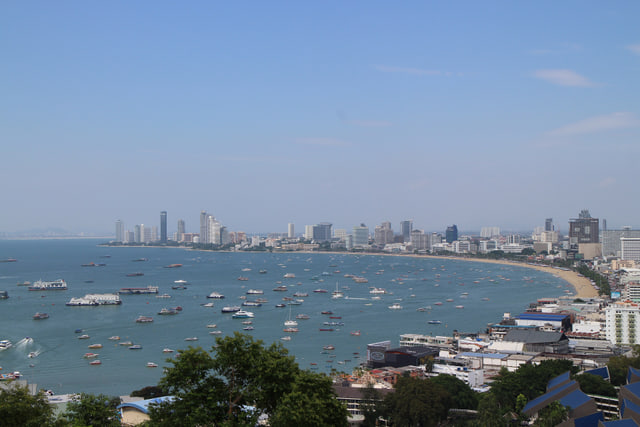
Phra Tamnak Mountain Viewpoint is a hill setting between South Pattaya and Jomtien, close to Bali Hai. TAT describes a view across the curved Pattaya beach and the skyline beyond it. The area also includes Wat Khao Phrabat, associated with a Buddha footprint, and the Prince of Chumphon naval monument.
These are different subjects from the golden Big Buddha at Wat Phra Yai, which has its own guide and map record. Compare the viewpoint, hillside City Sign and Pattaya Park Tower by what each represents: a bay panorama, skyline lettering or a coastal observation tower.
Sources for the added description
Digitally researched on . Comparisons organise the supported place descriptions; they are not recommendations from the cited operators.
Golden seated Buddha, approximate dimensions and weekday images; 1977 date is not used because the grammatical attachment could be misunderstood; largest claim, fees/hours/access omitted.
The indexed TAT text supports geography and landmarks; direct page retrieval intermittently returns its empty application shell. Position resolved from a separately dated OSM query; see map additions evidence.
Provider resize; CSS crops and tones the image for display. Original photograph retained by its source. Small interface thumbnails are local proportional resizes and JPEG re-encodings of the display photograph. No crop or subject edits; source author, capture date and license are retained.
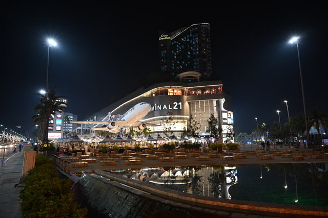
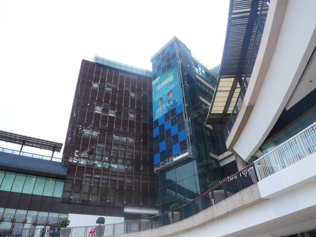
Browse shops and food floors arranged around Paris, London, Italy, Tokyo, San Francisco and Hollywood themes.
Six city themes under one roof
Terminal 21 Pattaya gives its shopping floors a sequence of city themes: Paris, London, Italy, Tokyo, San Francisco and Hollywood. The operator labels the ground floor Paris, mezzanine London and upper themed floors Italy through Hollywood. A food court is listed on the third floor, within the San Francisco theme.
The floor themes give this shopping stop a different browsing identity from Central Pattaya's beachfront complex. Use the operator's directory to explore the current shops and food options, then compare the nearby northern art ideas by their subject: painted illusions, wooden architecture or miniature landmarks.
Sources for the added description
Digitally researched on . Comparisons organise the supported place descriptions; they are not recommendations from the cited operators.
Six named themed floors and food-court identity; mixed navigation includes other taxonomy, only Pattaya named floor sequence used. Promotions excluded.
Beachfront complex, department-store/cinema, forecourt and hotel composition; tenant counts/occupancy/superlatives excluded. No availability guarantee.
Archived source full and preview JPEGs are Wikimedia provider resizes. Downloaded source JPEGs are preserved. Local proportional AVIF and JPEG derivatives are documented separately; no retouching or subject edits. CSS crops and tones the photograph to fit the interface; full-photograph mode retains its aspect ratio. Small interface thumbnails are local proportional resizes and JPEG re-encodings of the display photograph. No crop or subject edits; source author, capture date and license are retained.
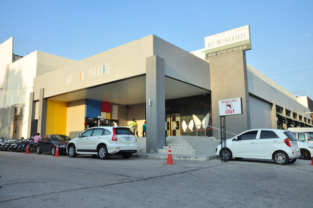
Pose within painted optical illusions and use perspective to make the artwork appear three-dimensional in your own pictures.
Perspective, pictures and painted worlds
Art in Paradise is a gallery built around painted optical illusions and photographs that make visitors appear part of the scene. TAT's descriptions include marine, wildlife, dinosaur and waterfall subjects among the themed picture settings. The three-dimensional effect comes from painted perspective, rather than miniature buildings or the wooden carving used at other northern landmarks.
That distinction helps when comparing the northern art ideas: pictures and poses here, architectural scale at Mini Siam, and carved forms at the Sanctuary of Truth. This guide refers to the Pattaya branch on Pattaya Sai 2.
Sources for the added description
Digitally researched on . Comparisons organise the supported place descriptions; they are not recommendations from the cited operators.
Full delivery is the unmodified original; preview is a Wikimedia provider resize. Downloaded source JPEGs are preserved. Local proportional AVIF and JPEG derivatives are documented separately; no retouching or subject edits. CSS crops and tones the photograph to fit the interface; full-photograph mode retains its aspect ratio. Small interface thumbnails are local proportional resizes and JPEG re-encodings of the display photograph. No crop or subject edits; source author, capture date and license are retained.
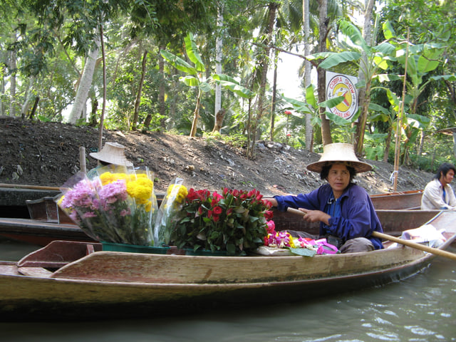
Explore shops, crafts and cultural displays organized around the northern, central, northeastern and southern regions of Thailand.
Four regions in one market setting
Pattaya Floating Market is a constructed cultural attraction organized around Thailand's northern, central, northeastern and southern regions. Its water-market setting uses wooden houses and regional themes to explain traditional ways of life and crafts. TAT associates northern crafts with carved wood and paper umbrellas, northeastern crafts with distinctive silk traditions, and southern crafts with batik and coconut products.
Those examples explain the attraction's regional theme; they are not a live inventory of goods for sale. Compare this market setting with Terminal 21's city-themed shopping floors or Underwater World's aquarium displays.
Sources for the added description
Digitally researched on . Comparisons organise the supported place descriptions; they are not recommendations from the cited operators.
Six named themed floors and food-court identity; mixed navigation includes other taxonomy, only Pattaya named floor sequence used. Promotions excluded.
Tunnel-zone labels and learning displays; about page says more than 105m versus existing homepage 105m, length not added/refreshed here. Animal/activity availability and superlatives omitted.
TAT describes a purpose-built cultural tourism attraction.
Its market theme represents four regions of Thailand.
Full delivery is the unmodified original; preview is a Wikimedia provider resize. Downloaded source JPEGs are preserved. Local proportional AVIF and JPEG derivatives are documented separately; no retouching or subject edits. CSS crops and tones the photograph to fit the interface; full-photograph mode retains its aspect ratio. Small interface thumbnails are local proportional resizes and JPEG re-encodings of the display photograph. No crop or subject edits; source author, capture date and license are retained.
Locate Dongtan's stretch of coast and compare its position with Pattaya Park Tower and Jomtien Beach.
Place Dongtan on the coast
This is Dongtan Beach in the Pattaya–Jomtien area, identified by a beachfront operator whose address is in Jomtien, Nong Prue, Bang Lamung. The operator explicitly places its site on Dongtan Beach south of Pattaya. The explorer's existing beach record sits beside Pattaya Park and north of the main Jomtien shoreline.
Use those positions to compare a beach idea with the tower's elevated coastal view and Jomtien's longer waterfront. The map marker identifies the mapped feature's centre for orientation, rather than a verified beach entrance.
Sources for the added description
Digitally researched on . Comparisons organise the supported place descriptions; they are not recommendations from the cited operators.
Only beachfront identity/location is used from the operator. This is not an endorsement or a claim about quiet, swimming, amenities or public access. The government Dongtan entry in Sattahip is a different beach.
Full delivery is the unmodified original; preview is a Wikimedia provider resize. Downloaded source JPEGs are preserved. Local proportional AVIF and JPEG derivatives are documented separately; no retouching or subject edits. CSS crops and tones the photograph to fit the interface; full-photograph mode retains its aspect ratio. Small interface thumbnails are local proportional resizes and JPEG re-encodings of the display photograph. No crop or subject edits; source author, capture date and license are retained.
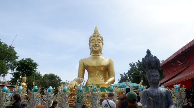
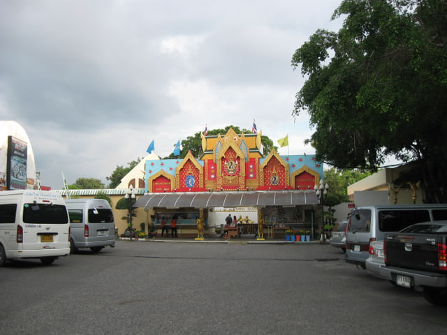
Visit the temple centered on a large golden seated Buddha, with smaller Buddha images arranged around it.
A temple with its own identity
Wat Phra Yai's defining subject is a golden seated Buddha, described by TAT Japan as approximately eighteen metres high. Smaller Buddha images around the main figure represent the days of the week. TAT Japan also describes views from the temple toward Pattaya's beaches and city.
Keep this temple distinct from Wat Khao Phrabat and the naval monument described in the Phra Tamnak viewpoint guide. Khao Chi Chan is another different Buddhist landmark: its image is engraved into a mountain face farther south, rather than forming the temple's golden seated statue.
Sources for the added description
Digitally researched on . Comparisons organise the supported place descriptions; they are not recommendations from the cited operators.
Golden seated Buddha, approximate dimensions and weekday images; 1977 date is not used because the grammatical attachment could be misunderstood; largest claim, fees/hours/access omitted.
Pattaya branch confirmed by address and page title. Google embed viewport coordinates are not treated as verified feature coordinates; fees, hours and access conditions are omitted. Position resolved from a separately dated OSM query; see map additions evidence.
Archived source full and preview JPEGs are Wikimedia provider resizes. Downloaded source JPEGs are preserved. Local proportional AVIF and JPEG derivatives are documented separately; no retouching or subject edits. CSS crops and tones the photograph to fit the interface; full-photograph mode retains its aspect ratio. Small interface thumbnails are local proportional resizes and JPEG re-encodings of the display photograph. No crop or subject edits; source author, capture date and license are retained.
Browse a beachfront shopping complex with restaurants, a department store and cinema in the middle of the bay.
Shopping on the central waterfront
Central Pattaya is a shopping complex on Pattaya's main beachfront. The developer's description combines a shopping mall with the Hilton Pattaya hotel and identifies a department store, cinema, restaurants and retail shops. It also describes an arena in front of the mall as part of the complex's layout.
The useful distinction is its position beside the central bay, while Terminal 21 organizes its shopping floors around different city themes farther north. Browse the waterfront and the shopping idea separately, then use the operator's current directory for individual tenants and activities.
Sources for the added description
Digitally researched on . Comparisons organise the supported place descriptions; they are not recommendations from the cited operators.
Beachfront complex, department-store/cinema, forecourt and hotel composition; tenant counts/occupancy/superlatives excluded. No availability guarantee.
Six named themed floors and food-court identity; mixed navigation includes other taxonomy, only Pattaya named floor sequence used. Promotions excluded.
Central Pattana identifies it as a beachfront shopping complex.
The complex includes a Central department store and SFX cinema.
Archived source full and preview JPEGs are Wikimedia provider resizes. Downloaded source JPEGs are preserved. Local proportional AVIF and JPEG derivatives are documented separately; no retouching or subject edits. CSS crops and tones the photograph to fit the interface; full-photograph mode retains its aspect ratio. Small interface thumbnails are local proportional resizes and JPEG re-encodings of the display photograph. No crop or subject edits; source author, capture date and license are retained.
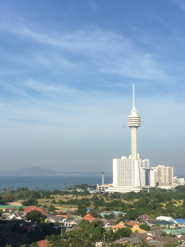
Compare an elevated tower visit with the open hill viewpoints, and explore the operator's observation and dining options.
A different kind of coastal view
Pattaya Park Tower is an observation-tower idea at the northern end of Jomtien. TAT describes views of both Pattaya Beach and Jomtien Beach from the fifty-fifth floor. The resort's legacy page identifies the observation level separately from revolving-restaurant floors below it.
This is a different type of viewpoint from Phra Tamnak's hill setting: the subject here is a tall coastal building and its elevated outlook. Compare its position with Dongtan Beach and the longer Jomtien shoreline, then check the operator before choosing any restaurant or tower activity.
Sources for the added description
Digitally researched on . Comparisons organise the supported place descriptions; they are not recommendations from the cited operators.
Full delivery is the unmodified original; preview is a Wikimedia provider resize. Downloaded source JPEGs are preserved. Local proportional AVIF and JPEG derivatives are documented separately; no retouching or subject edits. CSS crops and tones the photograph to fit the interface; full-photograph mode retains its aspect ratio. Small interface thumbnails are local proportional resizes and JPEG re-encodings of the display photograph. No crop or subject edits; source author, capture date and license are retained.
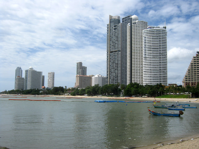
Spend time along the crescent shoreline north of Pattaya Beach and look back at the coastal skyline.
The northern crescent
Wong Amat is a crescent-shaped beach in Na Kluea, north of Pattaya's main waterfront. The Department of Tourism directory links its name to the former Wongamat Hotel, giving the beach a history separate from its present surroundings. The useful starting point is that northern coastal position and the shape of the bay.
Compare it with Pattaya Beach's central waterfront and Jomtien's longer southern shoreline. The Sanctuary of Truth supplies a separate wooden-architecture idea in the explorer's northern coastal group. The beach marker is an orientation centre, not a verified entrance.
Sources for the added description
Digitally researched on . Comparisons organise the supported place descriptions; they are not recommendations from the cited operators.
Full delivery is the unmodified original; preview is a Wikimedia provider resize. Downloaded source JPEGs are preserved. Local proportional AVIF and JPEG derivatives are documented separately; no retouching or subject edits. CSS crops and tones the photograph to fit the interface; full-photograph mode retains its aspect ratio. Small interface thumbnails are local proportional resizes and JPEG re-encodings of the display photograph. No crop or subject edits; source author, capture date and license are retained.
Walk between miniature versions of Thai and international landmarks, from temple architecture to familiar world monuments.
Landmarks at another scale
Mini Siam brings Thai and international architecture together as reduced-scale landmark models. TAT describes one-to-twenty-five reconstructions and names Thai examples including Wat Phra Kaeo and Hua Lamphong railway station. Its international examples include Angkor Wat, Tower Bridge, the Leaning Tower of Pisa and the Eiffel Tower.
The subject here is the shape and scale of buildings that normally belong to different places. Compare that model collection with Art in Paradise's painted perspective scenes and the Sanctuary of Truth's full-size carved wooden structure. Each provides a different way to browse the northern group's architecture and art ideas.
Sources for the added description
Digitally researched on . Comparisons organise the supported place descriptions; they are not recommendations from the cited operators.
Archived source full JPEG is the unmodified original; preview JPEG is a Wikimedia provider resize. Downloaded source JPEGs are preserved. Local proportional AVIF and JPEG derivatives are documented separately; no retouching or subject edits. CSS crops and tones the photograph to fit the interface; full-photograph mode retains its aspect ratio. Small interface thumbnails are local proportional resizes and JPEG re-encodings of the display photograph. No crop or subject edits; source author, capture date and license are retained.
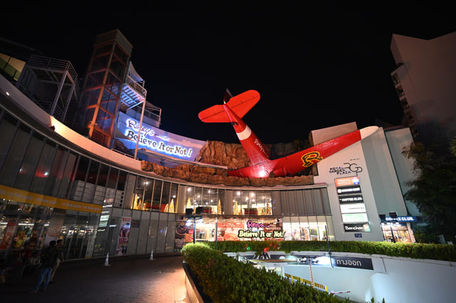
Explore the Odditorium's collection of unusual objects, or compare the separate attractions offered by the same operator.
The collection behind the name
Ripley's Believe It or Not! Pattaya is an Odditorium centred on a walk-through collection of unusual objects. The operator describes more than three hundred oddities and identifies its Pattaya venue on Beach Road. Its website separately lists experiences such as Louis Tussaud's Waxworks and the Infinity Maze alongside the Odditorium.
Distinguish the museum collection from those other named experiences before comparing a ticket or package. For another picture-focused gallery idea, compare Art in Paradise's painted illusions; for a shopping and cinema stop, compare Central Pattaya. They have different subjects even though the explorer groups them as indoor ideas.
Sources for the added description
Digitally researched on . Comparisons organise the supported place descriptions; they are not recommendations from the cited operators.
Beachfront complex, department-store/cinema, forecourt and hotel composition; tenant counts/occupancy/superlatives excluded. No availability guarantee.
The operator describes more than 300 oddities in the museum collection.
Full and preview are Wikimedia provider resizes. Downloaded source JPEGs are preserved. Local proportional AVIF and JPEG derivatives are documented separately; no retouching or subject edits. CSS crops and tones the photograph to fit the interface; full-photograph mode retains its aspect ratio. Small interface thumbnails are local proportional resizes and JPEG re-encodings of the display photograph. No crop or subject edits; source author, capture date and license are retained.
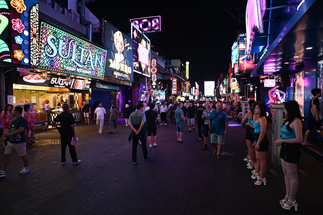
Locate the entertainment street at the southern end of Pattaya's central beach and follow its position toward Bali Hai.
Locate the southern entertainment strip
Walking Street is an entertainment-street idea on the South Pattaya waterfront. The local shopping-centre operator's visitor guide places its course along South Pattaya Beach toward Bali Hai Pier. That geographic relationship helps distinguish the southern entertainment strip from the rest of Beach Road, whose central and southern sections also include shopping and restaurant uses.
Compare the street's position with Pattaya Beach and the hill-side City Sign before choosing which part of the bay you want to explore. This guide identifies the district; it does not select or review individual venues.
Sources for the added description
Digitally researched on . Comparisons organise the supported place descriptions; they are not recommendations from the cited operators.
Full and preview are Wikimedia provider resizes. Downloaded source JPEGs are preserved. Local proportional AVIF and JPEG derivatives are documented separately; no retouching or subject edits. CSS crops and tones the photograph to fit the interface; full-photograph mode retains its aspect ratio. Small interface thumbnails are local proportional resizes and JPEG re-encodings of the display photograph. No crop or subject edits; source author, capture date and license are retained.
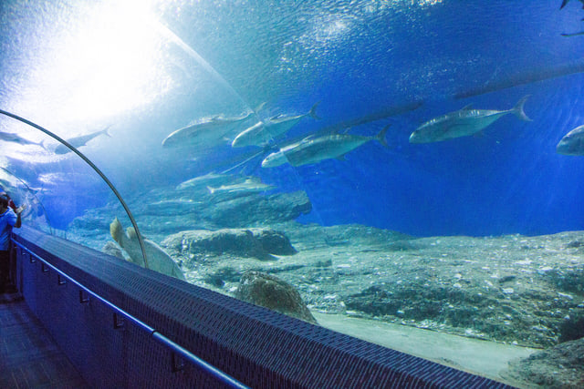
Explore an aquarium whose walk-through tunnel brings reef fish, sharks and rays into view around you.
Meet the aquarium’s different zones
Underwater World Pattaya is an aquarium on Sukhumvit Road in Nong Prue, Bang Lamung. Its operator describes a clear acrylic viewing tunnel arranged around coral-reef, shark-and-stingray and Giant of Siam zones. The same description identifies a jellyfish display and explanatory information about the exhibits.
The subject is marine-life viewing through aquarium displays, rather than the painted underwater scenes at Art in Paradise. Compare it with the Floating Market for a different inland idea: an aquarium's exhibit themes here, and regional culture and crafts there. Use the operator for current exhibit and visitor details.
Sources for the added description
Digitally researched on . Comparisons organise the supported place descriptions; they are not recommendations from the cited operators.
Tunnel-zone labels and learning displays; about page says more than 105m versus existing homepage 105m, length not added/refreshed here. Animal/activity availability and superlatives omitted.
Operator tunnel length takes precedence over TAT Japan's rounded 100 metres. The existing raw OSM aquarium-named way is Pattaya Dolphinarium, so it must not be used for this venue. Position resolved from a separately dated OSM query; see map additions evidence.
Full and preview are Wikimedia provider resizes. Downloaded source JPEGs are preserved. Local proportional AVIF and JPEG derivatives are documented separately; no retouching or subject edits. CSS crops and tones the photograph to fit the interface; full-photograph mode retains its aspect ratio. Small interface thumbnails are local proportional resizes and JPEG re-encodings of the display photograph. No crop or subject edits; source author, capture date and license are retained.
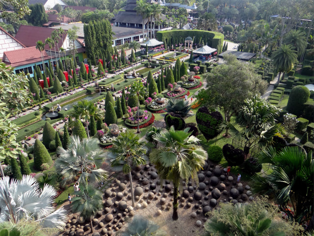
Explore landscaped gardens and visitor displays, including dinosaur figures and cultural museum collections.
Gardens with different visual themes
Nong Nooch combines designed garden settings with themed visitor displays in the Na Jomtien–Sattahip area. The operator describes a French Garden inspired by geometric arrangements at Versailles and a Stonehenge Garden with stones arranged in a circle. Its March 2026 visitor highlights also identify Dinosaur Valley and a Khon mask museum.
These subjects give the garden idea several different visual themes: planted design, stone arrangements, figures and cultural collections. Keep it as a wider-region outing when comparing it with Khao Chi Chan's cliff image or Aquaverse's movie-themed attractions.
Sources for the added description
Digitally researched on . Comparisons organise the supported place descriptions; they are not recommendations from the cited operators.
Dinosaur Valley and Khon mask museum identity only; plant/count/award claims, expired contest offers, separate research collection omitted.
Garden operator ↗ Accessed 8 October 2026 · retrieved indexed primary text; direct access limited.
Geometric design inspiration and garden identity, not guaranteed access or current flowers. Direct page initially identified but later section/find requests returned internal errors; proposed claims rely on retrieved indexed operator text.
Visitor highlights and main-address identity only. The separate research botanical collection is not open to the public; plant counts, awards, shows and current packages are not asserted.
Map position
Farther-south day idea; no point is plotted on the coastal atlas.
Archive photograph by Wayne77 · 2014-02-05 09:30:41
Full and preview are Wikimedia provider resizes. Downloaded source JPEGs are preserved. Local proportional AVIF and JPEG derivatives are documented separately; no retouching or subject edits. CSS crops and tones the photograph to fit the interface; full-photograph mode retains its aspect ratio. Small interface thumbnails are local proportional resizes and JPEG re-encodings of the display photograph. No crop or subject edits; source author, capture date and license are retained.
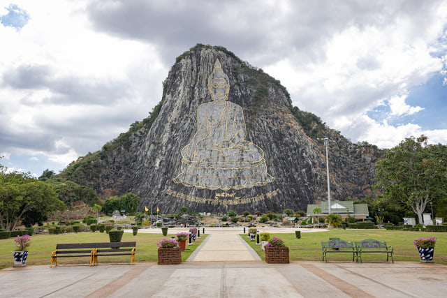
See the Buddha image engraved into a cliff, created to commemorate King Bhumibol's golden jubilee in 1996.
The image within the mountain
Khao Chi Chan is a Buddha image engraved into a mountain face in Na Chom Thian, Sattahip. TAT dates it to 1996, when it was created to mark the fiftieth anniversary of King Bhumibol's reign. The same account describes a mountain face that had previously been partly cut for construction material, and identifies the image as a seated Buddha in the pose of subduing Mara.
Its defining feature is the image within the cliff, distinct from Wat Phra Yai's golden seated Buddha. Compare it with the other wider-region day ideas by subject: designed gardens at Nong Nooch or movie-themed attractions at Aquaverse.
Sources for the added description
Digitally researched on . Comparisons organise the supported place descriptions; they are not recommendations from the cited operators.
Golden seated Buddha, approximate dimensions and weekday images; 1977 date is not used because the grammatical attachment could be misunderstood; largest claim, fees/hours/access omitted.
Garden operator ↗ Accessed 8 October 2026 · retrieved indexed primary text; direct access limited.
Geometric design inspiration and garden identity, not guaranteed access or current flowers. Direct page initially identified but later section/find requests returned internal errors; proposed claims rely on retrieved indexed operator text.
Water-park operator ↗ Accessed 8 October 2026 · retrieved indexed primary text; direct access limited.
Movie-themed water and land attraction labels; direct retrieval errors, package/ride availability, dimensions, live shows, travel promises omitted.
TAT dates its creation to the 50th anniversary of King Bhumibol's reign in 1996.
Identity, purpose and district only; published dimensions and hours vary elsewhere and are omitted. The Google map viewport center is not reused as a verified point.
Map position
Farther-south day idea; no point is plotted on the coastal atlas.
Archive photograph by Mastertongapollo · 2025-12-18
Full and preview are Wikimedia provider resizes. Downloaded source JPEGs are preserved. Local proportional AVIF and JPEG derivatives are documented separately; no retouching or subject edits. CSS crops and tones the photograph to fit the interface; full-photograph mode retains its aspect ratio. Small interface thumbnails are local proportional resizes and JPEG re-encodings of the display photograph. No crop or subject edits; source author, capture date and license are retained.
Compare movie-themed attractions such as Ghostbusters and Jumanji with the park's wave pool and other activities.
Film themes across water and land
Columbia Pictures Aquaverse is a movie-themed park in Bang Saray, south of the urban Pattaya waterfront. The operator describes Ghostbusters raft attractions and a Jumanji water-slide complex, with the Mega Wave Pool as another named park feature. Its website also lists land-based themes such as Gran Turismo racing and Emoji mini golf.
The useful distinction is the mix of film themes with water-park and other attractions. Compare this wider-region idea with Nong Nooch's gardens and Khao Chi Chan's cliff image, then check the operator's current attraction details and package inclusions.
Sources for the added description
Digitally researched on . Comparisons organise the supported place descriptions; they are not recommendations from the cited operators.
Water-park operator ↗ Accessed 8 October 2026 · retrieved indexed primary text; direct access limited.
Movie-themed water and land attraction labels; direct retrieval errors, package/ride availability, dimensions, live shows, travel promises omitted.
Water-park operator ↗ Accessed 8 October 2026 · retrieved indexed primary text; direct access limited.
Named park zones only; direct retrieval errors, hours conflict/weekly closing day, ticket inclusions and testimonials omitted.
Garden operator ↗ Accessed 8 October 2026 · retrieved indexed primary text; direct access limited.
Geometric design inspiration and garden identity, not guaranteed access or current flowers. Direct page initially identified but later section/find requests returned internal errors; proposed claims rely on retrieved indexed operator text.
Attraction identity only. TAT's 2024 brochure and the current operator disagree on the weekly closing day; hours, travel-time promises, ticket inclusions and ride restrictions are not repeated.
Map position
Farther-south day idea; no point is plotted on the coastal atlas.
Abstract category artwork illustrates a day-idea theme; it does not depict the destination.
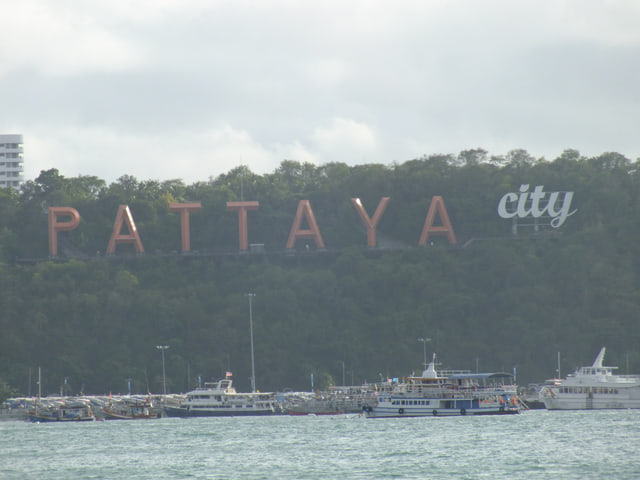
Locate the hillside Pattaya City lettering and see how it sits between the central bay and the Pratumnak headland.
A landmark in the skyline
The Pattaya City Sign is the hillside lettering associated with Khao Pattaya, also called Khao Phra Tamnak. Pattaya City's 2021 planning document identifies the sign as an existing landmark on a hill overlooking the curve of the bay. The same existing-area description includes the naval monument and temple context of the hill.
Treat the letters as a skyline landmark and map anchor, while keeping the Phra Tamnak viewpoint and Pattaya Park Tower as separate ideas. Comparing the records helps distinguish the city's hillside name, a bay panorama and a tower's elevated coastal view.
Sources for the added description
Digitally researched on . Comparisons organise the supported place descriptions; they are not recommendations from the cited operators.
Page 1 documents the existing landmark. Proposed skywalk and other future developments are not described as completed; current access is not established.
Archived source full and preview JPEGs are Wikimedia provider resizes. Downloaded source JPEGs are preserved. Local proportional AVIF and JPEG derivatives are documented separately; no retouching or subject edits. CSS crops and tones the photograph to fit the interface; full-photograph mode retains its aspect ratio. Small interface thumbnails are local proportional resizes and JPEG re-encodings of the display photograph. No crop or subject edits; source author, capture date and license are retained.
These four collections organize the existing map guides. Their geographic descriptions and browsing prompts come from the editorial snapshot checked on . This readable organization was compiled on ; it is not a new source check.
Wong Amat & North
Wong Amat sits on the Naklua side of the city, north of the main Pattaya Beach curve. The Sanctuary of Truth gives this coast an architectural anchor. Farther south, Terminal 21 and Art in Paradise bring shopping and illusion art into the same part of the map; Mini Siam sits farther east. Browse the coast and the inland attractions separately to understand the distances between your ideas.
Editorial grouping and relative directions derived from existing OSM positions. No claim of a continuous beach route or walkable connections.
Look along the northern coast — Compare Wong Amat Beach with the Sanctuary's shoreline setting.
Choose your kind of art — Carved architecture, picture illusions or miniature landmarks: see how the experiences differ.
Make a shopping stop — Explore Terminal 21's destination-themed floors and operator directory.
Pattaya Beach and Beach Road define the main bay. Shopping and dining line the central and southern waterfront, with Central Pattaya and Ripley's offering two very different indoor stops. Walking Street sits toward the southern end, in the direction of Bali Hai. Use the bay's shape to orient yourself first, then choose a place that matches what you want to do.
Geographic overview, not live crowd reporting or an assertion that every waterfront section has the same uses.
Get your waterfront bearings — Start at the beach and locate Central Pattaya behind the coast.
Find an indoor idea — Compare a shopping complex with Ripley's collection of unusual objects.
Locate the evening district — See where Walking Street sits at the southern end of the bay.
Phra Tamnak is the hill between South Pattaya and Jomtien. Its viewpoint looks back across the main bay; the Pattaya City sign belongs to the same headland. Wat Phra Yai is a separate temple destination centered on the golden Big Buddha. Toward the coast, Pattaya Park Tower and Dongtan Beach offer another way to explore the area. Open each record to distinguish the experience before choosing a stop.
TAT supports the hill's location between the two beach areas. The municipal document supports the sign's hill setting. No slope, accessible route or journey duration inferred.
Choose a view of the city — Compare a hill viewpoint, the hillside lettering and the observation tower.
Explore the Big Buddha — Understand the temple's main image and the smaller day-of-the-week Buddhas.
Find the coastal edge — Locate Dongtan Beach beside Pattaya Park and northern Jomtien.
Jomtien is a distinct shoreline south of the main Pattaya bay, with a beach extending roughly six kilometres. Its inland choices include the four-region Floating Market and Underwater World on Sukhumvit Road. Beyond the urban waterfront, Nong Nooch, Khao Chi Chan and Aquaverse belong to the Na Jomtien–Sattahip side of the region. Treat those as separate day ideas, rather than nearby stops on a Jomtien beach walk.
This editorial area includes clearly labeled wider-region day ideas. It is not a municipal boundary, and it does not claim these attractions are adjacent or connected by a verified route.
Explore the Jomtien shoreline — Locate the long beach and compare it with Dongtan at the northern edge.
Look inland — Compare a regional market theme with an aquarium tunnel experience.
Make room for a day idea — Choose among landscaped gardens, the cliff Buddha and a movie-themed water park.
The optional Tilt view has 327 locally sourced building footprints. Six have source height tags; 321 heights are explicitly illustrative estimates. No invented footprints or live building status are implied.
21 digitally sourced archive photographs are included. Exact place matches are used for 19 guides. The overview photo shows Pattaya Bay from Phra Tamnak Hill. Its temporary loading preview is a local crop, resize and mildly softened derivative of the same credited archive photograph; the full-resolution photograph stays unchanged. Photographs retain their historical dates and do not show current crowd or operating conditions.
Matched guide photographs also have local AVIF deliveries, proportionally resized at supported widths up to native full width. Original photographs and JPEG fallbacks retain their individual credits and licenses. Processing adds no retouching or subject edits; orientation is preserved. Original scene derivatives were prepared on 6 October 2026, and the expanded library on 8 October 2026. Processing dates are separate from each photograph's source check and each place's information date.
Pattaya bay / coast from Phra Tamnak Hill — Radek Kucharski from Warsaw, Poland · Taken on 7 December 2015 14:10. Source file ↗ · CC BY 2.0 ↗
Provider resize; CSS crops and tones the image for display. Original photograph retained by its source. Small interface thumbnails are local proportional resizes and JPEG re-encodings of the display photograph. No crop or subject edits; source author, capture date and license are retained.
Provider resize; CSS crops and tones the image for display. Original photograph retained by its source. Small interface thumbnails are local proportional resizes and JPEG re-encodings of the display photograph. No crop or subject edits; source author, capture date and license are retained.
Provider resize; CSS crops and tones the image for display. Original photograph retained by its source. Small interface thumbnails are local proportional resizes and JPEG re-encodings of the display photograph. No crop or subject edits; source author, capture date and license are retained.
Provider resize; CSS crops and tones the image for display. Original photograph retained by its source. Small interface thumbnails are local proportional resizes and JPEG re-encodings of the display photograph. No crop or subject edits; source author, capture date and license are retained.
Provider resize; CSS crops and tones the image for display. Original photograph retained by its source. Small interface thumbnails are local proportional resizes and JPEG re-encodings of the display photograph. No crop or subject edits; source author, capture date and license are retained.
Photograph source checked .
Sanctuary of Truth detail — Mustang Joe · Taken on 7 November 2024, 09:44:24. Source file ↗ · CC0 1.0 ↗
Provider resize; CSS crops and tones the image for display. Original photograph retained by its source. Small interface thumbnails are local proportional resizes and JPEG re-encodings of the display photograph. No crop or subject edits; source author, capture date and license are retained.
Photograph source checked .
Terminal 21 Pattaya airplane and mall exterior at night — PattayaPatrol · 2025-01-24 22:51:10. Source file ↗ · CC BY-SA 4.0 ↗
Archived source full and preview JPEGs are Wikimedia provider resizes. Downloaded source JPEGs are preserved. Local proportional AVIF and JPEG derivatives are documented separately; no retouching or subject edits. CSS crops and tones the photograph to fit the interface; full-photograph mode retains its aspect ratio. Small interface thumbnails are local proportional resizes and JPEG re-encodings of the display photograph. No crop or subject edits; source author, capture date and license are retained.
Photograph source checked .
Beach Road exterior of CentralFestival Pattaya Beach — Arthur Taksin · 2023. Source file ↗ · CC BY 4.0 ↗
Archived source full and preview JPEGs are Wikimedia provider resizes. Downloaded source JPEGs are preserved. Local proportional AVIF and JPEG derivatives are documented separately; no retouching or subject edits. CSS crops and tones the photograph to fit the interface; full-photograph mode retains its aspect ratio. Small interface thumbnails are local proportional resizes and JPEG re-encodings of the display photograph. No crop or subject edits; source author, capture date and license are retained.
Photograph source checked .
Golden Big Buddha at Wat Khao Phra Yai, Pattaya — Alharomain354 · 2025-11-24 13:25:51. Source file ↗ · CC BY-SA 4.0 ↗
Archived source full and preview JPEGs are Wikimedia provider resizes. Downloaded source JPEGs are preserved. Local proportional AVIF and JPEG derivatives are documented separately; no retouching or subject edits. CSS crops and tones the photograph to fit the interface; full-photograph mode retains its aspect ratio. Small interface thumbnails are local proportional resizes and JPEG re-encodings of the display photograph. No crop or subject edits; source author, capture date and license are retained.
Archived source full JPEG is the unmodified original; preview JPEG is a Wikimedia provider resize. Downloaded source JPEGs are preserved. Local proportional AVIF and JPEG derivatives are documented separately; no retouching or subject edits. CSS crops and tones the photograph to fit the interface; full-photograph mode retains its aspect ratio. Small interface thumbnails are local proportional resizes and JPEG re-encodings of the display photograph. No crop or subject edits; source author, capture date and license are retained.
Photograph source checked .
Pattaya City sign on the wooded headland above Bali Hai — SquidHomme · 2014-07-27 16:45:33. Source file ↗ · CC BY-SA 4.0 ↗
Archived source full and preview JPEGs are Wikimedia provider resizes. Downloaded source JPEGs are preserved. Local proportional AVIF and JPEG derivatives are documented separately; no retouching or subject edits. CSS crops and tones the photograph to fit the interface; full-photograph mode retains its aspect ratio. Small interface thumbnails are local proportional resizes and JPEG re-encodings of the display photograph. No crop or subject edits; source author, capture date and license are retained.
Full delivery is the unmodified original; preview is a Wikimedia provider resize. Downloaded source JPEGs are preserved. Local proportional AVIF and JPEG derivatives are documented separately; no retouching or subject edits. CSS crops and tones the photograph to fit the interface; full-photograph mode retains its aspect ratio. Small interface thumbnails are local proportional resizes and JPEG re-encodings of the display photograph. No crop or subject edits; source author, capture date and license are retained.
Full delivery is the unmodified original; preview is a Wikimedia provider resize. Downloaded source JPEGs are preserved. Local proportional AVIF and JPEG derivatives are documented separately; no retouching or subject edits. CSS crops and tones the photograph to fit the interface; full-photograph mode retains its aspect ratio. Small interface thumbnails are local proportional resizes and JPEG re-encodings of the display photograph. No crop or subject edits; source author, capture date and license are retained.
Full delivery is the unmodified original; preview is a Wikimedia provider resize. Downloaded source JPEGs are preserved. Local proportional AVIF and JPEG derivatives are documented separately; no retouching or subject edits. CSS crops and tones the photograph to fit the interface; full-photograph mode retains its aspect ratio. Small interface thumbnails are local proportional resizes and JPEG re-encodings of the display photograph. No crop or subject edits; source author, capture date and license are retained.
Photograph source checked .
Underwater World Pattaya aquarium tunnel — Aleksey Maramzin · 2013-08-17 13:32:49. Source file ↗ · CC BY-SA 4.0 ↗
Full and preview are Wikimedia provider resizes. Downloaded source JPEGs are preserved. Local proportional AVIF and JPEG derivatives are documented separately; no retouching or subject edits. CSS crops and tones the photograph to fit the interface; full-photograph mode retains its aspect ratio. Small interface thumbnails are local proportional resizes and JPEG re-encodings of the display photograph. No crop or subject edits; source author, capture date and license are retained.
Full and preview are Wikimedia provider resizes. Downloaded source JPEGs are preserved. Local proportional AVIF and JPEG derivatives are documented separately; no retouching or subject edits. CSS crops and tones the photograph to fit the interface; full-photograph mode retains its aspect ratio. Small interface thumbnails are local proportional resizes and JPEG re-encodings of the display photograph. No crop or subject edits; source author, capture date and license are retained.
Full and preview are Wikimedia provider resizes. Downloaded source JPEGs are preserved. Local proportional AVIF and JPEG derivatives are documented separately; no retouching or subject edits. CSS crops and tones the photograph to fit the interface; full-photograph mode retains its aspect ratio. Small interface thumbnails are local proportional resizes and JPEG re-encodings of the display photograph. No crop or subject edits; source author, capture date and license are retained.
Full delivery is the unmodified original; preview is a Wikimedia provider resize. Downloaded source JPEGs are preserved. Local proportional AVIF and JPEG derivatives are documented separately; no retouching or subject edits. CSS crops and tones the photograph to fit the interface; full-photograph mode retains its aspect ratio. Small interface thumbnails are local proportional resizes and JPEG re-encodings of the display photograph. No crop or subject edits; source author, capture date and license are retained.
Full delivery is the unmodified original; preview is a Wikimedia provider resize. Downloaded source JPEGs are preserved. Local proportional AVIF and JPEG derivatives are documented separately; no retouching or subject edits. CSS crops and tones the photograph to fit the interface; full-photograph mode retains its aspect ratio. Small interface thumbnails are local proportional resizes and JPEG re-encodings of the display photograph. No crop or subject edits; source author, capture date and license are retained.
Photograph source checked .
Ripley’s Pattaya exterior at Royal Garden Plaza — PattayaPatrol · 2025-12-12 21:56:56. Source file ↗ · CC BY-SA 4.0 ↗
Full and preview are Wikimedia provider resizes. Downloaded source JPEGs are preserved. Local proportional AVIF and JPEG derivatives are documented separately; no retouching or subject edits. CSS crops and tones the photograph to fit the interface; full-photograph mode retains its aspect ratio. Small interface thumbnails are local proportional resizes and JPEG re-encodings of the display photograph. No crop or subject edits; source author, capture date and license are retained.
Full and preview are Wikimedia provider resizes. Downloaded source JPEGs are preserved. Local proportional AVIF and JPEG derivatives are documented separately; no retouching or subject edits. CSS crops and tones the photograph to fit the interface; full-photograph mode retains its aspect ratio. Small interface thumbnails are local proportional resizes and JPEG re-encodings of the display photograph. No crop or subject edits; source author, capture date and license are retained.
Photograph source checked .
Weather source
The on-demand weather outlook uses MET Norway’s Locationforecast model for a fixed reference point near Pattaya. Its panel displays model/update, retrieval and expiry information. The model is not a street-level crowd, ride-hailing, road or flood sensor.
 pattaya